
Libraries
Libraries
Paisajes y representación del «pueblo de indios». Un estudio introductorio y seis casos
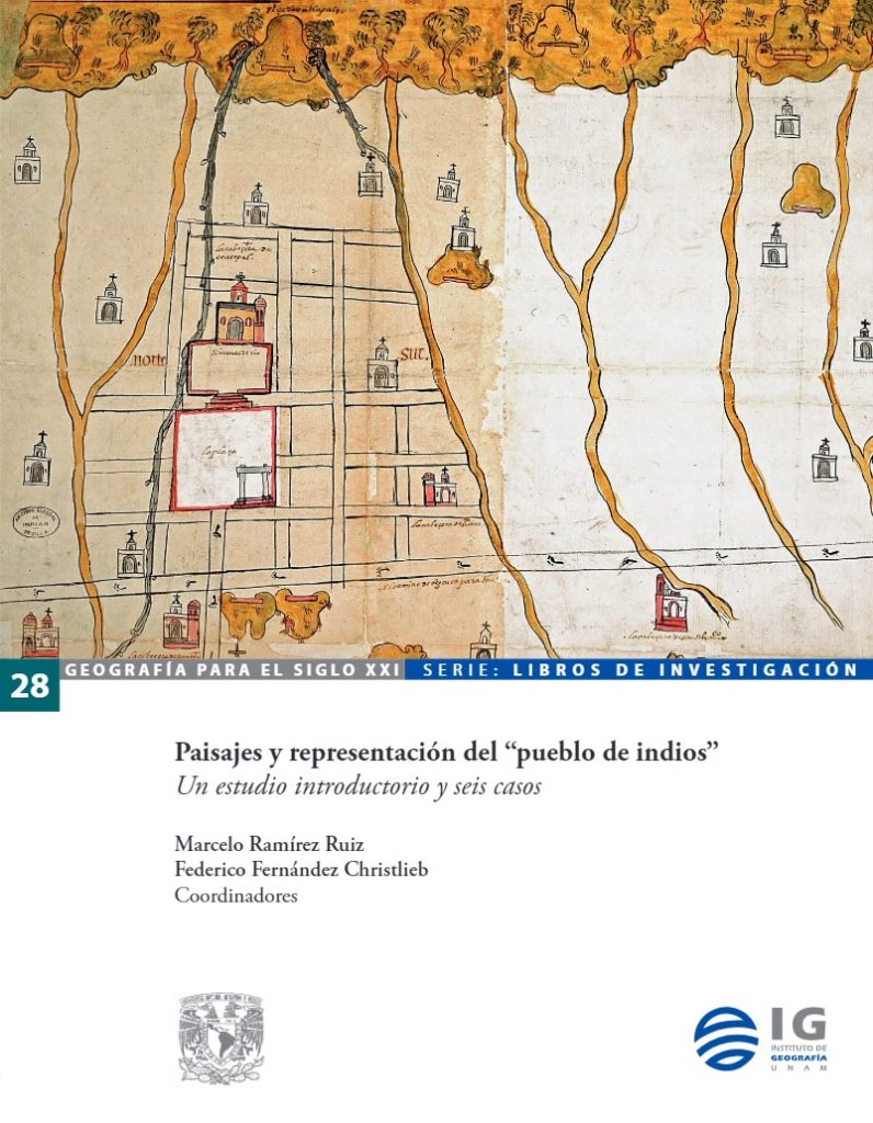
The «pueblo de indios» was the socio-political, religious and territorial organisation into which the indigenous settlements were transformed during the New Spain regime. Their layout was often distributed along a river and on one side of the hills of pre-Hispanic sacredness, as can be seen in the paintings that depicted them, which were at the same time landscapes, views, plans and maps. Indian villages were founded in the vicinity of Spanish towns and cities, and also in the vast highlands of New Spain.
This book studies the landscape and cartographic representation of Indian villages. Landscape is not a neutral space; therefore, from the historical, geographical and cartographic analysis, the researchers have chosen to apply a cultural approach. This approach allows them to note that a river, a valley or a locality do not mean the same thing to all the communities that inhabit or frequent these spaces, nor to all the observers that these geographical features represent. Thus, the introductory study of this book delves into reflections on the complex relationship between landscape as space and landscape as representation.
The next three chapters analyse materials and representations dating from the New Spain period: the 1579 painting from the “Relación Geográfica de Metztitlán” (present-day state of Hidalgo), considered the oldest known European-type landscape painting in that part of New Spain; the 1580 painting from the “Relación de Teozacualco y Amoltepeque”, state of Oaxaca; and the 1754 map of San Francisco Zacualpan, state of Morelos. The final three chapters deal with themes of independent Mexico.